Heads up: some links on this page are affiliate links (Stay22, Viator). If you book through them we may earn a commission at no extra cost to you. It never changes what we recommend. How this works.
What is the Pipiwai Trail?
The Pipiwai Trail is a roughly 4-mile out-and-back hike in the Kipahulu District of Haleakala National Park, reached by the Road to Hana. You’ll walk through rainforest and a bamboo grove, pass a giant banyan tree and the Makahiku Falls overlook, then reach a designated viewing area for Waimoku Falls. Plan on a moderate hike, not a quick roadside stop.
Quick answer: Published route figures put the round trip at about 4 miles, with reported elevation gain ranging from about 650 to 800 feet. Allow around 2 to 3 hours, or longer if you take breaks or the trail is muddy. The bamboo forest is a highlight, but the falls viewing area is the turnaround point, and current access or swimming status at the nearby Oheo Gulch pools should be confirmed before you go.
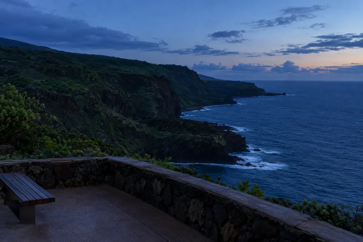
The trail is in the park’s Kipahulu District, about 10 to 12 miles past Hana town according to published guides. That difference is a reminder to follow directions to the Kipahulu Visitor Center area rather than treating the mileage as an exact turn-by-turn guide. RedAwning’s trail guide places it about 10 miles past Hana, while Condé Nast Traveler describes it as about 12 miles past town.
If you’re building a full day around the route, use our Road to Hana guide for the broader drive plan and Haleakala National Park guide for the park’s two districts. Kipahulu is not the summit district, so don’t assume a visit to one means you’ve seen the other.
How long is the hike, and how much does it climb?
Use 4 miles round trip as your planning distance. The trail is an out-and-back route, so you return on the same path. Reported elevation gain varies: one guide lists about 650 feet, while others give about 780 to 800 feet. That’s a useful range, not a reason to plan around a precise GPS number. RedAwning gives the lower figure; U.S. News Travel and Parkwolf report about 800 feet.
| Planning detail | What to expect |
|---|---|
| Route | About 4 miles round trip, out and back |
| Elevation gain | Published estimates range from about 650 to 800 feet |
| Time | About 2 to 3 hours in one guide; allow longer if conditions slow you down |
| Difficulty | Moderate, with roots, rocks, steps and potentially muddy footing |
| Turnaround | Designated viewing area for Waimoku Falls |
Trail listings can show a shorter digital line than the full route. Parkwolf explains that its connected map line measures about 1.6 miles each way, while the park’s planning distance is 4 miles round trip. For your schedule, use the full route rather than relying on the smaller number shown in a map app. Parkwolf’s route notes explain the discrepancy.
Expect uneven ground, boardwalks, bridges, roots and rock steps, not a smooth paved path. A published guide says the hike may take up to 3 hours, and Parkwolf recommends allowing 3 to 4 hours. The extra margin is sensible if recent rain has made the trail slick or you want time to stop along the way. U.S. News Travel describes it as moderately difficult, and Parkwolf gives a longer planning estimate.
What do you see along the way?
The walk is more than a march to one waterfall. The trail follows the Pipiwai Stream valley and includes several distinct stops, so a steady pace with brief pauses usually makes more sense than rushing through to the end.
- Makahiku Falls overlook: A viewpoint appears early in the hike. Sources place the waterfall at about 185 to 200 feet tall, so treat those as approximate descriptions rather than a surveyed height. Condé Nast Traveler gives 185 feet, while RedAwning describes it as about 200 feet.
- Giant banyan tree: The tree is a recognizable stop before the longer climb and bamboo section. It’s a landmark along the route, not the trail’s endpoint. The trail’s reference listing also notes the banyan and bamboo forest among its features.
- Bamboo forest: A boardwalk and bridges carry hikers through sections of dense bamboo. It’s the signature stretch for many visitors, but boardwalks don’t remove the need to watch your footing on the approach and exit.
- Waimoku Falls: The route ends at a designated viewing area for the roughly 400-foot waterfall. Stay behind posted barriers and don’t continue toward the falls base. Parkwolf’s trail guidance specifically says to stop at the marked viewing area.
What is the bamboo forest like?
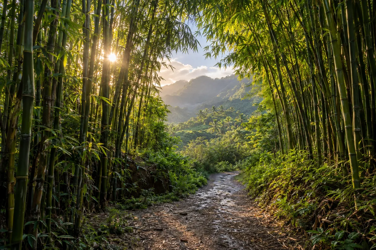
The bamboo grove is the part of the hike that gives the route its distinctive feel. Tall stalks crowd around the trail, and a long boardwalk crosses sections of the grove. Condé Nast Traveler notes that the stalks click together in the wind, a detail that captures why this section feels different from the earlier forest path. Read its Pipiwai Trail review.
Parkwolf places the start of the bamboo forest around a mile into the hike. That means you’ll have already walked a meaningful portion of the route before reaching it, and you still have the climb to Waimoku Falls and the return walk afterward. Parkwolf’s route guide describes the boardwalks and footbridges through the grove.
Don’t plan the hike as a quick bamboo photo stop. The full route is the better choice if you’re comfortable with a moderate, uneven trail and have enough time for the return. If the footing is muddy, slow down; the boardwalk is only one part of the hike. For other walking options around Maui, see our Maui hikes guide.
Are the Seven Sacred Pools open for swimming?
Oheo Gulch, also called the Pools of Oheo, is near the Pipiwai Trail in the coastal part of the Kipahulu District. “Seven Sacred Pools” is a widely used nickname, but it doesn’t tell you whether the pools are open or safe to enter on a particular day.
The available information is inconsistent on swimming. Parkwolf says swimming in the pools is not allowed, while RedAwning describes the pools’ location but does not provide a current access or swimming status. Don’t plan on getting in the water based on an old photo, a previous visit, or the nickname. Check current park notices and posted rules at the visitor center before approaching the pools. Parkwolf’s guide states swimming is not allowed; RedAwning does not establish current access.
Conditions around streams can change after rain upstream. RedAwning warns that streams may rise quickly and advises against entering or crossing them during or after heavy rain. Follow any closure signs and don’t treat a pool or waterfall as a swimming spot unless park staff and posted rules say it is open. For other waterfall access notes around the island, see Maui waterfalls you can reach.
What are the fees and logistics?
The trail is inside Haleakala National Park, so a park entrance pass is required. Published pages list a $30 vehicle fee and a $15 individual or pedestrian fee, with the vehicle pass described as valid for three days. One guide also says a valid America the Beautiful annual federal lands pass is accepted. These prices come from third-party pages without a clear current effective date, so confirm the latest fee directly with the National Park Service before leaving. RedAwning’s fee listing and U.S. News Travel’s fee listing give those amounts.
Don’t confuse the entrance pass with a separate parking charge. The notes identify parking in the Kipahulu Visitor Center area but don’t establish a separate parking fee. They also disagree or leave gaps on reservations: U.S. News Travel says park admission must be reserved online in advance, while other listings don’t confirm that rule. Check current National Park Service guidance before the drive rather than assuming either an advance reservation or walk-up entry is guaranteed.
The parking area is by the Kipahulu Visitor Center, where restroom facilities and water are reported to be available. Bring your own food for the hike and drive; Parkwolf says there is no food sold in the park. There’s no public transportation to the trailhead according to U.S. News Travel, so arrange a car or a tour rather than expecting a local bus to get you there. Parkwolf’s visitor notes cover water and food, and U.S. News Travel notes the lack of public transport.
Some published information gives the park as open around the clock, but the same guide warns that the parking gate is locked at the end of the day, including when cars remain inside. Treat daylight access and the gate as practical limits, not a reason to start late. Verify current hours and any closures with the park. U.S. News Travel’s trail page describes the gate warning.
What should you bring, and what should you watch for?
Kipahulu is described as humid and rainy, and the trail can be muddy or slippery even if the start of your day seems dry. Wear sturdy, closed-toe shoes with traction, carry water, and bring a hat and mosquito repellent. There are roots, rocks, uneven steps and wet patches, so sandals or smooth-soled shoes are a poor fit for this hike. U.S. News Travel recommends water, a hat, repellent and sturdy shoes; Parkwolf notes the uneven and slippery footing.
Rain matters beyond comfort. Streams can rise quickly after rain in the uplands, so don’t enter or cross a stream during or after heavy rain. Check posted conditions before setting out, stay on the marked route, and respect barriers at Waimoku Falls. Pets are prohibited on park trails according to Parkwolf, so leave them behind. RedAwning’s safety notes warn about rising streams, while Parkwolf covers barriers and pets.
The trip is also a long drive on a winding road. If the drive itself is a concern, compare a guided option with self-driving before committing to a full day; our Road to Hana tour versus driving guide lays out that choice. Don’t squeeze the hike into a schedule that leaves no margin for trail conditions or the return drive.
How we researched this
We compared published hiking guides, a map listing and trail-specific route notes, including pages that point readers toward National Park Service hiking information. The sources differ on elevation gain, fees, reservation requirements and current pool access, so we’ve shown those differences instead of presenting uncertain details as settled facts. We did not receive payment from any business mentioned, and we did not claim personal visits.
Before you go
Use 4 miles round trip and roughly 650 to 800 feet of gain for planning, and leave enough time to walk back the same way. Check National Park Service information for current fees, reservations, gate access, closures and pool rules before driving to Kipahulu. Pack water, food, closed-toe shoes and rain-ready layers, then turn around at the posted Waimoku Falls viewing area.
Frequently asked questions
How long is the Pipiwai Trail to Waimoku Falls?
Plan for about 4 miles round trip on the out-and-back route. Published estimates put the elevation gain between about 650 and 800 feet.
Is the bamboo forest on the Pipiwai Trail?
Yes. The trail crosses a dense bamboo grove with boardwalks and footbridges. It is partway along the hike, not a separate roadside stop.
Are the Seven Sacred Pools at Oheo Gulch open for swimming?
Current status should be confirmed with the park. One trail guide says swimming is not allowed, and access can depend on posted rules and conditions.
How much does it cost to visit the Pipiwai Trail?
Published guides list a $30 vehicle pass and a $15 individual or pedestrian pass, but those listings may not reflect current prices. Confirm the current Haleakala National Park fee and any reservation rules before you go.
Sources we checked
- Condé Nast Traveler: Pipiwai Trail review, distance and waterfall details
- U.S. News Travel: Pipiwai Trail route, timing, fees and visitor guidance
- Parkwolf: trail distance, elevation, route features and safety notes
- RedAwning: trail overview, elevation estimate, fees and stream warnings
- Wikipedia: Pipiwai Trail landmarks and general route description
About this guide
Written and fact-checked by the Maui Hotels Blog editors, an independent team that plans Maui trips from official and published sources. We compared 5 sources for this page, linked each one above, and were not paid by any business mentioned. Prices, fees, hours, reservation rules and ocean conditions change, so confirm with the official source before you go.