Heads up: some links on this page are affiliate links (Stay22, Viator). If you book through them we may earn a commission at no extra cost to you. It never changes what we recommend. How this works.
The best Maui hikes depend on where you’re staying and how much climbing you want. For waterfalls, choose Pipiwai Trail near Hana; for an easy coast walk, try Kapalua; for a hard ridge climb, Waihee Ridge is the standout; and for a volcano hike, start with a short out-and-back on Sliding Sands rather than committing to the crater crossing.
Trail lengths and access vary, and several popular routes have no trail-specific permit information in published guides. Check the relevant park or land manager before you drive, especially for Haleakala National Park, Iao Valley and Waianapanapa. The notes below separate confirmed parking and reservation details from information you’ll need to verify.
Quick answer: Pipiwai is the top pick for Maui hikes with waterfalls, while Twin Falls is a shorter waterfall outing. Kapalua Coastal Trail and Hosmer Grove suit easier walks; Waihee Ridge, Hoapili and Haleakala’s crater routes require more fitness or preparation. Start early, carry water, and turn back before a route becomes more than you can safely finish.
Which Maui hike fits your trip?
Use this quick comparison to narrow the choices. Distances are generally round trip unless the route is identified as one-way or a point-to-point hike. Sources sometimes report different lengths because hikers take different spurs, start from different access points, or describe a shorter turnaround rather than the full route.
| Hike | Area | Length and effort | Best for | Access note |
|---|---|---|---|---|
| Kapalua Coastal Trail | West Maui | About 1.75 to 4 miles; easy to moderate depending on route | Ocean views and a flexible walk | Parking options vary by access point |
| Waihee Ridge Trail | Central / northwest Maui | About 4 to 5 miles; moderate to strenuous | Ridge views and a real climb | Arrive early; free parking is reported |
| Twin Falls | Road to Hana | About 2 miles in one guide; easy to moderate | A short waterfall outing | Private site; a guide lists a $10 car fee |
| Pipiwai Trail | Kipahulu, East Maui | About 4 miles; intermediate | Bamboo forest and Waimoku Falls | Haleakala National Park admission |
| Hoapili Trail | South Maui | About 4 to 5.5 miles; difficult in heat | Lava coast and historic route | Exposed terrain; no facilities listed |
| Sliding Sands | Haleakala summit | Short out-and-back to a full-day route | Crater scenery | Park admission; sunrise visit has separate reservation rules |
The distances and difficulty descriptions in this guide come from published trail guides, which don’t always use the same turnaround point. The table is a planning tool, not a substitute for checking current trail conditions. Hawaii Guide ranks trails by scenery, access, condition and effort, while Love Big Island groups routes by difficulty.
West Maui: coastal walks and a steep ridge
Kapalua Coastal Trail: easiest scenic choice
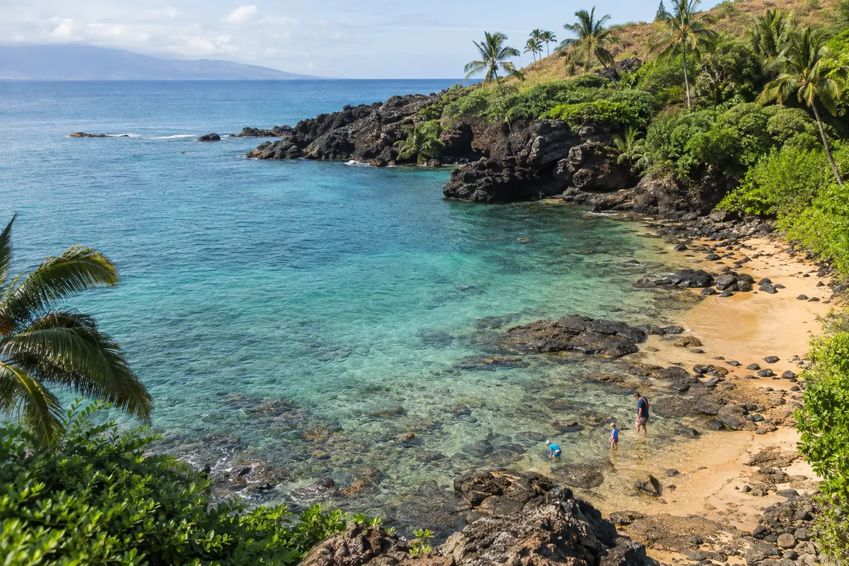
The Kapalua Coastal Trail connects Kapalua Bay with D.T. Fleming Beach Park, passing lava shoreline, wave views and resort-front sections. One guide describes a 1.75-mile easy route; other guides give roughly 3.5 to 4 miles round trip for a longer out-and-back. In practice, you can make this a short stroll or continue farther along the coast, but rocky ups and downs make the longer option less like a flat promenade.
Parking depends on where you start. A published guide lists free parking at the Kapalua Bay and D.T. Fleming Beach Park lots. A July 2026 traveler review, however, reported a $45 total after tax and service fees at Kapalua Resort Association lots using Parklinq. Those are different lots and reports, so check posted signs and payment instructions rather than assuming every nearby space is free. The trail has no trail reservation listed in the guides. Stay well back from the Honokahua burial site and view it respectfully from a distance. Lonely Planet covers the route and free beach-lot parking; Tripadvisor’s Maui trail listings include the later parking report.
Waihee Ridge Trail: best West Maui climb
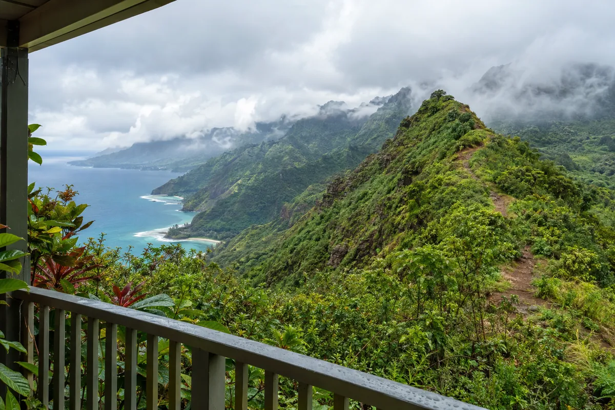
Waihee Ridge is the choice for hikers who want a sustained climb and broad views across Waihee Valley, the coast and, on clear days, toward Molokai. The common out-and-back is about 4 to 5 miles with roughly 1,200 to 1,500 feet of elevation gain. Guides estimate around 3 to 4 hours, and one recommends allowing at least 3.5 hours. The first paved section is steep; after that, expect a dirt trail, exposed ridge and changeable weather.
Get there early. The trail is often clearer in the morning, with clouds sometimes moving into the valley later. The parking area is about a 7-mile drive from Wailuku, and visitors report free parking. One account says overflow parking can add more than 2 miles of walking, so don’t count on a space near the trailhead. Rain can leave the route muddy and slippery; postpone it if conditions make the ridge unsafe. The trail is described as not requiring a reservation, but check current access information before setting out. Maui Hawaii’s hiking guide gives the 5-mile distance and 1,500-foot gain; Hawaii.com describes the climb and muddy conditions.
East Maui: waterfall hikes and Hana-side trails
Pipiwai Trail: best waterfall hike on Maui
If you’re choosing one substantial waterfall hike, make it Pipiwai Trail in Haleakala National Park’s Kipahulu district, beyond Hana. The route is about 4 miles round trip and usually takes 2 to 3 hours, though a half-day is a sensible allowance if you want time for stops. It climbs through a bamboo forest and past stream and waterfall scenery to a view of 400-foot Waimoku Falls. The trail is shaded in places, but roots, mud and uneven ground still call for proper shoes.
Start early if you can. One guide says tour buses begin arriving around 10 a.m. and recommends arriving before 9 a.m.; another suggests an early start to avoid the busiest part of the day. This is a long drive from the resort areas, so it’s usually paired with a Road to Hana day rather than treated as a quick stop. Check weather and obey any closures: flash floods can develop in the valley without warning. The park’s Kipahulu visitor center is at the trailhead, and the listed park admission is $30 per vehicle, valid for three days at both the summit and Kipahulu entrances. Fees can change, so confirm with Haleakala National Park before leaving. Hawaii.com gives the trail timing, waterfall height and park fee; Hawaii Guide describes the bamboo forest and half-day plan.
Twin Falls and Waikamoi Ridge: shorter Hana Highway stops
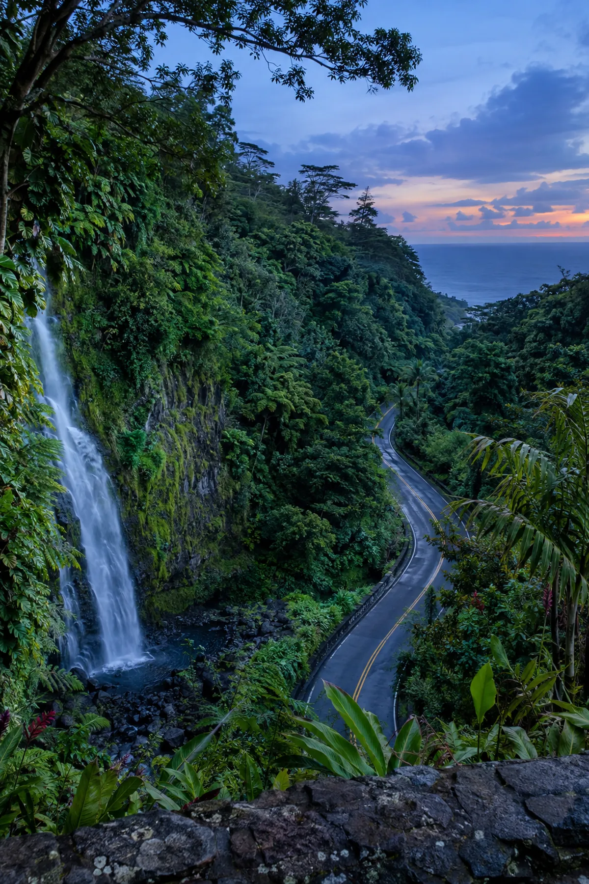
Twin Falls, near mile marker 2 on the Hana Highway, is a more accessible waterfall outing. One guide describes a roughly 2-mile out-and-back; another says the visit takes about 55 to 60 minutes, with the exact route depending on which falls are accessible. It’s generally described as easy to moderate and family-friendly, but expect crowds. The site is private, and a published Maui guide lists a $10-per-car entry fee. Confirm current access, fees and which areas are open with the property before you go. Bring water and shoes that can handle wet ground. A waterfall pool is not automatically safe for swimming, and stream conditions can change after rain. Maui Hawaii lists the example entry fee; Hawaii Guide explains why the route length varies.
Waikamoi Ridge, near mile marker 9.5, is a modest alternative if you want rainforest without a long hike. The short loop and out-and-back are described as about 1.5 miles, with a 30-to-60-minute estimate in another guide. Roots and mud are common issues, so this is an easy option only when you’re comfortable on uneven ground. There’s a parking lot at the trailhead, but the guides don’t give a fee or reservation rule. Check current trail status before making it a planned stop. Love Big Island describes the route and trailhead; Hawaii Guide notes roots, picnic tables and variable trail length.
Kuloa Point and Waianapanapa
Kuloa Point Trail is a short, easy walk at Kipahulu, about half a mile round trip. It leads from the visitor center toward the ocean, past historic walls and cultural sites, to the coast and pools where the stream meets the sea. It works as a brief add-on to Pipiwai, not a substitute for the longer hike. Check with park staff about conditions before considering any water entry; the flow can be risky.
Waianapanapa State Park, near Hana, offers short trails, black shoreline, lava formations and cultural sites, with a longer coastal route described as about 3 miles. Advance parking reservations are required according to a published guide. Reserve through the current state park system and check time-slot, entry and parking requirements before driving there. The park guide lists public restrooms, showers and picnic areas, but facilities and reservations can change. Love Big Island describes the coastal trail and reservation requirement; Hawaii Guide covers the short Kuloa Point route.
South Maui: exposed lava and coastal routes
Hoapili Trail at La Perouse Bay
Hoapili Trail, also called the La Perouse or King’s Highway route, is a difficult-feeling walk over sharp lava beside an exposed coastline. Published distances range from about 4 to 5.5 miles for the described routes; shorter walks are possible if you turn back early. The appeal is the stark ʻaʻa lava landscape, small coastal coves and remains associated with the historic route. It’s hot, dry and largely without shade, so this is not a good choice for a midday walk or for anyone without suitable footwear and enough water.
Follow Makena Road to La Perouse Bay, where the road ends. The guides don’t state a parking fee or reservation rule for the trail, and they list no facilities or lifeguard. Don’t mistake a remote coastline for a supervised swimming area; check the ocean conditions and stay out if surf or currents look dangerous. Pack water, snacks, sun protection and closed-toe shoes. The trail is described as part of a culturally significant historic route, so stay on the established path and treat any sites respectfully. Lonely Planet describes the coastal route; Love Big Island gives the 5.5-mile option and practical footwear advice.
For a shorter South Maui outing, the La Perouse area has short walks over lava and sea estuaries, but the guides don’t give a dependable single distance for all the paths. Treat these as exposed walks rather than shaded nature trails. If you’re staying in Kihei or Wailea, check the Maui beaches guide for other coastal stops, and compare Maui base areas if you’re deciding where to sleep between hiking days.
Haleakala: crater and summit-area hikes
Sliding Sands: go in only as far as you can climb back
Sliding Sands, or Keoneheehee, starts near the summit visitor center and descends into Haleakala’s crater through cinder and volcanic formations. The first overlook is a short option; many day hikers walk a limited distance and turn around well before the crater floor. Published descriptions range from an 11-mile round trip for a long version to 17.8 miles for the full route, which can take up to two days. These are not casual day-hike distances at high elevation.
The downhill can feel deceptively easy. The return climbs on loose, sandy ground at close to 10,000 feet, and one guide says the climb out can take twice as long as the descent. Pick a turnaround point before you start, then turn around sooner if you feel unwell, the weather changes or your pace is slowing. Stay on the trail to protect native silversword plants. Bring warm layers, water and food, and allow time to adjust after driving from sea level. The park admission listed by one source is $30 per vehicle for three days; confirm current fees with Haleakala National Park. Sunrise visitors need a separate reservation through Recreation.gov; the cited guide says reservations open 60 days ahead, and visits after 7 a.m. don’t need that sunrise reservation. Verify current rules before booking. Hawaii Guide recommends a shorter out-and-back for day hikers; Hawaii.com explains the steep return and sunrise reservation details.
Halemauu Trail and Hosmer Grove
Halemauu Trail is another crater route, but it begins below the summit area and descends toward the crater floor. A shorter walk to a picnic or turnaround point is more manageable than combining it with Sliding Sands. The full crater crossing is a strenuous, roughly 10-mile route in one guide and requires transportation planning, such as a second car or a pickup at the other end. Don’t start a point-to-point hike without confirming how you’ll get back to your vehicle.
For a gentler Haleakala National Park stop, Hosmer Grove Loop is about half a mile through planted forest near the park entrance. It’s a good choice for families or for a short walk before or after a summit visit. It isn’t a waterfall or crater hike, and the trail guide lists no facilities at the loop itself. Check park access and conditions before driving uphill. Love Big Island gives the Halemauu route length; Hawaii Guide describes Hosmer Grove and the summit-area trail options.
Central Maui and Upcountry: forest, valley and ridge walks
Waihou Spring Trail near Makawao is an easy forest loop described as about 2.5 miles, with trees, small springs and a cooler, wooded setting than the coast. The guide gives no parking fee or permit information, so confirm current access before going. Kahakapao Loop in Makawao Forest Reserve is a longer, moderate option at about 6.6 miles, through forest and gulches. It’s a multi-use trail shared with bikers, dog walkers and equestrians, so stay alert and give other users room. Parking is at the recreation area; the guide describes the route to the lot but doesn’t list a fee.
Polipoli’s connected forest trails pass redwood, pine, cedar and eucalyptus at higher elevation. A guide describes a 3.5-mile combination of trails; the wider network has shorter and longer options. Polipoli is in a hunting area, so the cited guide advises wearing bright colors and watching for wild pigs and goats. Conditions and access can differ from the sunny coast, so bring a warm layer and check current reserve information.
Iao Valley State Monument is more a short paved viewpoint walk than a hike. The route gives a view of the 2,250-foot Iao Needle, with stairs in some places. Out-of-state visitors need reservations according to a published guide; check the current Hawaii State Parks reservation page for entry, parking and closure information before you go. Heavy rain can bring flash-flood risk, and the valley has had closures for repairs and improvements in published coverage, so don’t rely on an old itinerary. For other short activities, see our Iao Valley planning guide. Love Big Island covers Iao Valley reservations and forest trails; Hawaii Guide advises checking current state alerts.
Parking, reservations and trail safety
Confirm access before you drive. Haleakala National Park has a listed vehicle admission fee, and sunrise at the summit has its own reservation requirement. Waianapanapa requires advance parking reservations in the cited guide, and Iao Valley has a reservation system for non-residents. Twin Falls is privately operated and has been listed with an entry charge. These details can change; check the relevant park, state park or property information on the day you plan the visit.
Start early on exposed or popular routes. Early starts help with Waihee Ridge’s cloudier afternoons and Pipiwai’s later crowds. They also reduce the time you spend on exposed South Maui lava in the heat. Carry more water than you expect to need, along with snacks and sun protection. In the rainforest, bring footwear that can handle mud; on lava, choose closed-toe shoes that protect your feet.
Take weather and water seriously. Flash floods can develop in steep valleys and near streams, including the Kipahulu area. Don’t cross a flooded stream, enter a closed area or assume a waterfall pool is safe because other people are in it. At the Nakalele Blowhole, stay well back from the opening and incoming waves; visitors have died after being pulled into the blowhole. On coastal trails, check surf and current conditions rather than assuming the ocean is safe for swimming.
Stay on legal trails. Published Maui hiking guides warn against trespassing, parking illegally or following unpermitted guides onto land without permission. Some trails cross culturally significant places, including burial sites and historic routes. Keep to marked public paths, obey posted closures and leave the site as you found it. The Maui weather guide can help you understand the island’s wet and dry sides, but check local conditions before each hike.
How we researched this
We compared published Maui trail guides and cross-checked their descriptions of Haleakala National Park and Hawaii State Parks access, fees and reservations where those details were provided. Trail distances sometimes differ because sources describe different turnarounds or route combinations, so we show a range rather than imply false precision. We did not receive payment from any business mentioned.
Before you go
For an easy day, choose Kapalua Coastal Trail, Hosmer Grove or a short Hana-side stop. For waterfalls, Pipiwai is the strongest full hike, while Twin Falls takes less time but has private-site access and variable route conditions. If you’re unsure about fitness or weather, shorten the route and turn around early. For the longest drives, plan lodging around the hike: compare where to stay for a first Maui trip and the Road to Hana guide before locking in your itinerary.
Frequently asked questions
What are the best hikes in Maui?
Pipiwai Trail is a top choice for bamboo forest and Waimoku Falls. Waihee Ridge is a rewarding climb, and Kapalua Coastal Trail is a flexible, easier coastal walk.
Which Maui hikes have waterfalls?
Pipiwai Trail leads through bamboo forest to a view of 400-foot Waimoku Falls. Twin Falls is a shorter waterfall outing near the start of the Hana Highway, but access and which falls are open can vary.
What are some easy hikes in Maui?
Kapalua Coastal Trail, Hosmer Grove Loop and Kuloa Point Trail are good shorter options. Waikamoi Ridge is also relatively short, though roots and mud can make it less easy underfoot.
Do Maui hikes require permits or reservations?
Some do. The guides specify advance parking reservations for Waianapanapa, reservations for non-residents at Iao Valley, and a separate reservation for Haleakala sunrise visits. Confirm current requirements with the park or land manager before going.
How much does it cost to hike on Maui?
Many hikes are described as free, but Haleakala National Park has a listed vehicle admission fee, and some private or state park sites may charge or require reservations. Fees and access rules can change, so check the official site for your destination.
Sources we checked
- Hawaii Guide: Maui trail rankings, distances, difficulty and access notes
- Love Big Island: Maui hikes grouped by difficulty, with route and reservation details
- Lonely Planet: selected Maui hikes, route distances and coastal trail parking
- Tripadvisor: Maui hiking trail listings and 2026 traveler parking report
- Maui Hawaii: hiking advice, Haleakala fees, Twin Falls and Waihee Ridge
- Hawaii.com: Pipiwai, Haleakala summit trails, park fee and sunrise guidance
About this guide
Written and fact-checked by the Maui Hotels Blog editors, an independent team that plans Maui trips from official and published sources. We compared 6 sources for this page, linked each one above, and were not paid by any business mentioned. Prices, fees, hours, reservation rules and ocean conditions change, so confirm with the official source before you go.